Electronic white-lining, unique digital files linked to one-call ticket numbers, and an on-window excavator cab display: all may be elements of an excavation project in the year 2030, as detailed in a new report by the Common Ground Alliance, which promotes underground damage prevention.
CGA says that after reviewing case studies in its four technology reports to date, many of the elements needed to make an idealized excavation project a reality already exist.
A 2030 excavation job could look like this, says CGA:
Pre-construction: Contractors enter an electronic one-call ticket using electronic white-lining, after which the facility operators/locators respond by marking the site on time and providing and enhanced positive response (EPR). EPRs include a password- or QR-code protected unique digital file linked to the ticket, and contain maps/coordinates, photos, special instructions, etc.
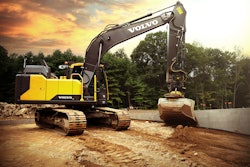
Construction: The EPR is compatible with the excavating machine hardware/software and can be uploaded to a screen in the cab. The machines are equipped with bucket sensors that warn the operator when they are close to a buried line. These sensors and buried lines are connected, perhaps by Bluetooth, RFID, marker balls, GPS satellites or another technology. If the machine gets too close to a critical line, it can be set to automatically shut down or freeze the machine's controls.
The one-call ticket sets geofences that define the perimeter of the work site, alerting the operator if they go within a certain distance of a buried line or over the perimeter. Alerts can be sent to all concerned parties; in addition, the system can also send alerts when a ticket needs to be renewed.
The EPR file can also be uploaded to a drone, allowing all parties to monitor what the drone's cameras are showing and communicating with the operator in real time. The operator can also direct the drone with voice-activated controls.
Post construction: All unmarked, mismarked or abandoned facilities found during the project can be mapped by the drone using integrated ground penetrating radar (GPR) and/or photos. This information can then be verified by facility operators, allowing them to update their files as needed.


Now happening
As CGA points out, certain elements of this 2030 vision are now in place. The report includes case studies on the following:
Gopher State One Call is using electronic white-lining to a digital base map. The resulting map, complete with virtual white lining is then shared by the one-call center with all facility operators, which can aid the locator in more easily and precisely determining the scope of work.
Sawback Technologies uses a lightweight, mountable GPR that can be used from above ground level and potentially be mounted on drones. Sawback's system maps and integrates the data into a visual layer that can be viewed via Google Maps. The company intends to make the same data accessible in point cloud format, allowing tools with the ability to visualize data in 3D, says the report.
Unearth Technologies' OnePlace is a map-based work management platform that allows users to capture, access and share data from anywhere, says the report, and is being applied to a cross bore detection and mitigation program. Theoretically it could also be applied to tracking abandoned facilities, stub-service lines, damage and near-miss locations, along with past excavations.
PelicanCorp's ScreenAccess program uses an automated solution for processing locate requests, comparing the job location to the location of the facility operators' network. Tickets are categorized based on the work being performed and the nature of the asset potentially at risk. Contractors receive an email outlining requirements for working in and around the buried facilities.
Established in 2000, CGA promotes damage prevention practices in underground infrastructure.