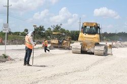
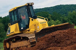
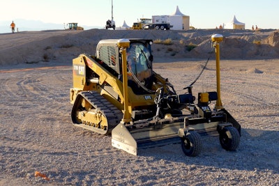
 Trimble’s new software products lower costs for GPS earthmoving on small machine attachments using fewer hardware components that traditional methods.
If you do a lot of work with skid steers, compact track loaders and mini-excavators, Trimble has developed a suite of products that will enable you to do many of the same things as contractors who run big equipment equipped with GPS machine control, but with less hardware and at a lower cost.
“Customers have seen the boom in machine control on the high end, and now they’re saying they want the same kind of technology on small machines,” says Alan Sharp, Trimble’s business area director for strategic software. These customers are building things like sidewalks, bicycle paths, parks, custom homes and small sites that often have complex topography, he says.
Trimble is meeting these needs with a two-pronged approach announced at its Dimensions conference in Las Vegas. First is software.
“We are using a common 3D technology but configuring it in slightly different ways,” says Sharp. “We still use GPS or laser positioning technology but the software inside is now connected to our field surveying system.”
This includes the EZ Level function which replaces traditional laser transmitters with GPS or total stations when used in the company’s SCS900 system, making it easy to check elevations when no design is available. And if the traditional GPS base station is beyond your budget, Trimble’s new BaseAnywhere software allows you to set up a Trimble SPS585 smart antenna and use it as a base station anywhere on the site without the need for survey control points.
Trimble also redesigned its GCS900 grade control system to work on many skid steer loader attachments and synchronize with the machines’ joystick controls for all the benefits of automated earthmoving.
SketchUp Pro
The second component is SketchUp, a 3D computer-based drawing program that Trimble bought from Google about four years ago.
“SketchUp is a low-cost, simple to use system,” says Sharp. “Kids use it to build their Eagle Scout projects. Adults use it to build their workbenches for their shops, or to design a living room. We are using that tool in a new way. We’ve added a new functionality with the ability to take a model and use it on the jobsite and use it without any control points.”
To use a SketchUp drawing with Trimble’s new field surveying systems, you only need two surveyed stakes in the ground, which are points on the model, says Sharp. “It positions and orientates the GPS to the model but it also positions and orientates the plan to the world’s GPS coordinate system. Then you can just press a button and it transfers the files to the machine. And now the machine can grade the whole project using a simple setup. That is a big change for the industry, enabling a huge customer base of SketchUp users around the world to facilitate the use of these small machines,” he says.
Trimble offers a free version of SketchUp via download. If you want the more advanced features mentioned above, the professional version costs about $500.
Complex made easy
Traffic roundabouts are an example of a type of project that’s tricky to design and difficult to execute in the field—the kind of job that Trimble’s new systems can greatly simplify. Trimble has been developing what it calls automated parametric design software tools that enable not just engineers, but contractors, to easily change any parameter of these complex shapes.
“By conventional means it would take hours, even days, to design a roundabout,” says Sharp. “But our parametric modeling allows us to build it and change any parameter—the grade, the slopes the width, the size of the radiuses—all interactively in a fully automated way. The technology, methodology and the engineering knowhow is very hard. But when you make it parametric, anybody can do it,” says Sharp.
“Trimble’s automated design technology is helping contractors to drive the business in the way it needs to be driven,” says Sharp. “More and more projects are getting let where the contractor is involved in the design process, and influencing the engineer. We’re enabling not just the engineers to do their job faster but the contractor as well.”
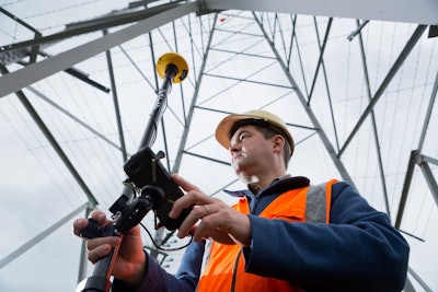 With Trimble’s Catalyst you can turn any Android device into a GPS rover with centimeter level accuracy.
Catalyst for mobile
Earthmoving and surveying applications require GPS signals accurate to a centimeter or so. That requires a base station, rover or machine, and survey control points.
But with a subscription to Trimble’s new software-defined Catalyst GNSS service and a small Trimble DA1 digital antennae you can turn any Android mobile device into a centimeter-level locating device.
The antenna is small enough to fit in a backpack or glovebox and will give a wide range of workers the ability to detect and log precise geoposition coordinates without the upfront investment or complexity of traditional GPS receivers.


