Change detection example from repeat pass images from a multi-temporal color digital camera (Pass 1 & 2) with automated change detection results in yellow. Courtesy: University of New Mexico
Researchers from the University of New Mexico (UNM), San Diego State University, and BAE Systems are working on a prototype drone system that could be used to detect and map transportation infrastructure damage as a result of natural disasters.
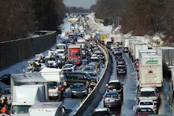
The benefit is the speed at which these machines can reach a disaster area, which many times can be inaccessible by engineers and inspectors for long periods of time. Plus, drones can often get close to an area that’s often difficult for inspectors to reach even in good conditions, such as under a bridge.
For the equipment, researchers are using a manned Quicksilver GT500 aircraft for development stages. NEOS Ltd. is supporting the research and development work. BAE Systems is implementing all the technology refined by the researchers, which will be worked into the Socet GXP software line. A series of demonstrations is planned for 2016 in Bernalillo County, New Mexico.
“We’ve been working on basic technology for really fast and precise change detection by aligning images to each other before a disaster and immediately after an event to detect anything that changed,” said Christopher Lippitt, an assistant professor in the Department of Geography & Environmental Studies. “We’ve been working on that in a number of applications for awhile, but this is the first time we’re fully operationalizing technology that myself and my collaborators at San Diego State have been developing for many years.”
This aligning of images Lippitt references is a technique called repeat station imaging. “I like to call it telemedicine for infrastructure,” said Lippitt. “We’re talking about being able to map every piece of critical infrastructure in minutes to hours as opposed to hours to days.”
To help develop the capabilities of the project, researchers are talking to transportation officials to actually assess what information is needed. Ultimately, the hope is that this remote viewing will become part of standard operating procedures for the U.S. Department of Transportation.


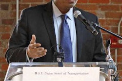
The USDOT clearly likes the ideas behind the project, as its Office of the Assistant Secretary for Research & Technology Commercial Remote Sensing and Spatial Information Technology Program provided $1.2 million in grant money.
“We’re proud to provide funding through a competitive basis to individuals and consortia teams of university research entities working in partnership with industry and state agencies,” said Transportation Assistant Secretary Greg Winfree. “To ensure safe and efficient movement of people and freight within the national transportation infrastructure system, this program executes projects dedicated to reduce inefficiencies, improve system performance, and assess infrastructure condition through implementation of applied research.”