Artist rendering of the South Mountain Freeway and I-10 West Valley interchange. (Arizona DOT)
The Arizona Department of Transportation (ADOT) partnered with the Frank Lloyd Wright Foundation to incorporate design aesthetics into the South Mountain Freeway.
 A mockup of a Frank Lloyd Wright-inspired design element.
Wright was in Arizona in the late 1920s to design a resort and created a temporary settlement named Ocatillo near what will be the Loop 202 South Mountain Freeway. The project ended, but ADOT plans to carry on his influence in how the bridges, sound walls and other elements of the freeway appear to motorists.
“Frank Lloyd Wright had a strong presence at the base of South Mountain before Ahwatukee was even built,” says Joe Salazar, ADOT’s roadside development, project landscape and architecture coordinator. “Frank Lloyd Wright was inspired by Arizona’s desert surroundings, and the South Mountain Freeway will tell that story.”
ADOT says preliminary plans call for using horizontal lines, featured in many of Wright’s designs. “The wood walls of Wright’s Ocatillo settlement featured bold horizontal lines to echo the desert floor and the area’s long horizons,” the agency says. The sound walls and retaining walls also will feature horizontal lines, contrasted with the vertical lines that are used on other freeways in the area.
“These horizontal lines evoke a sense of motion, a perfect complement to the energy of a freeway,” says Victor Sidy, an architect working with the Frank Lloyd Wright Foundation. “As one travels through the length of the freeway, these lines will serve as a connective thread that will narrate a story of transition from the city to the natural desert and back to the city.”
The Frank Lloyd Wright aesthetic will be incorporated into the freeway near the Ocatillo Settlement, Cholla Ocotillo between Elliott Road and east of Desert Foothills Parkway, River Bank between the Salt River Bridge and Elliot Road, Leaf Portal between Roosevelt Avenue and the Salt River Bridge and Mountain Urban Link between the I-10 (Papago Freeway)/Loop 202 interchange and Roosevelt Avenue.
ADOT says five landscape character areas will be associated with the design, including the Ahwatukee Neighborhood, Ahwatukee Foothills, Laveen Village, Estrella Village and Interstate 10 Traffic Interchange. These will incorporate specific plants, color accents, ground treatments and other elements.


“Together, these character areas will tell stories by highlighting land use, land forms and history,” ADOT says. “The Ahwatukee Foothills/Cholla Ocotillo segment, for example, will feature desert plants and simple shapes based on the forms of native cholla and ocotillo cactuses, while aesthetics and landscaping in the Laveen Village/River Bank segment will speak to that area’s agricultural heritage.”
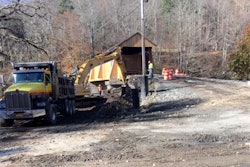
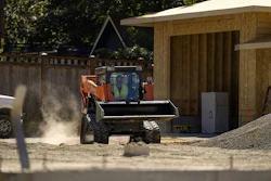
The South Mountain Freeways is expected to open by late 2019 and will stretch 22 miles between the East Valley and West Valley as an alternative to I-10 through downtown Phoenix.