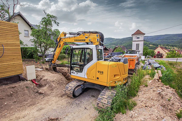
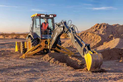
If you’re using utility locating systems before hand digging or vacuum excavating around One Call marks, you’re ahead of the curve. The majority of contractors don’t use utility locating devices, says Dave Gasmovic, president of McLaughlin Boring Systems. If you are one of those contractors, you could save yourself a lot of time and perhaps grief by pinpointing the exact location of utilities before exposing them.
Safety zones around One Call marks vary by state, but are usually 2 feet to either side of the mark, which may be off several inches. “If you’re going to use a vacuum excavator that excavates a 6-inch hole and you have 4 feet you might have to vacuum, that’s a lot of lost time,” Gasmovic says.
The two most common types of utility locating systems are ground-penetrating radar and electromagnetic, or radio frequency, devices. While radar can give you a picture of everything underground, electromagnetic locators trace a specific utility.
Determining which type of locator to use, or if you need to use both types, can be tricky. The decision depends on factors ranging from soil type to utility depth to how crowded the underground environment is.
“I like to stress that in this day and age it’s a combination of approaches that solves a problem,” says Matt Wolf, president of Mala GeoScience. “No one piece of equipment is going to give all the answers underground, and at some point, none of the technology gives you the answers you need. Sometimes they all fail.” And at that point you have to turn to hand digging or vacuum excavation.
Radar vs. radio-frequency locating
The experts we talked to point out that you have to be aware of the different restrictions that go along with radar and radio-frequency systems so you’ll know when you should turn to another locating technique.
“If someone shows up with just one type of equipment to do locating work, they’re not getting as much of the story as they could possibly get,” says Ronald LaBarca, president of US Radar. “Using both types is one more level of protection. It’s like getting a second opinion from a doctor.”


With that in mind, here are some pluses and minuses to the two types of systems.
Radio-frequency – also called electromagnetic – locators identify metallic pipe or cable by inducing a current. There are three ways to do this: by connecting directly to cable or pipe, through the use of a coil clamp or by inducing a signal from the transmitter into the metallic pipe. This creates an alternating current field on the cable. Utilities containing metal include telephone, gas and electric lines and some water and sewer pipes.
When direct connecting, radio detection is highly accurate and is quicker than radar at pinpointing a specific line because you’re putting a signal on that utility and can follow it precisely. With radar, you have to sweep the area where you think the utility is. Radar is also more expensive, with prices ranging from $8,500 to more than $25,000. You can buy a radio-frequency locator for $3,000 to $6,000.
But if you need to find PVC water and sewer pipes that don’t have a tracer wire, radar is your only option.
Radar sends energy into the earth, it hits something and bounces back, giving you an image. Fish finders work in a similar manner.
Another radar advantage is that it can give you a complete picture of the underground environment. With electromagnetic devices, you have to already know where a utility is in most cases in order to trace it. You have to direct connect to the utility or put a transmitter on the ground over the target.
Radar’s weakness, on the other hand, is soil type. Radar works best in sandy soil and may not work at all in extremely heavy clay soil, especially if you need to look deep into the ground. If you are considering buying a radar system, have it demonstrated at one of your jobsites first. Most manufacturers will be glad to do this. And don’t forget to consider the range of soil types in your geographic area. In some locations, soil type can vary significantly from one side of town to the other.
The following tips can help you get the best performance out of utility locating systems.
General Tips:
· Consult all facility maps prior to locating and expose utilities after you locate them.
· Have one employee become your guru of locating technology. When you hire new people, he or she can then train them properly.
· Use your eyes on the jobsite. If you’re locating lines going into a building and you locate the telephone and the gas lines, it’s common sense that the building is going to have electricity too. So if power lines aren’t overhead, you need to make sure you find them.
· Take advantage of training opportunities and best practice guidelines offered by locating system manufacturers and groups such as the Common Ground Alliance
(www.commongroundalliance.com).
Radio-frequency Tips:
· Don’t try to make the system do something it can’t because of frequency or power.
· Pay attention to current measurement. If you’re locating a gas line, make sure the signal hasn’t jumped off to a telephone line. If the signal skips to another line, you’ll see a big variation in current measurement. Current usually goes down in a logical progression as you move away from the transmitter.
· To get the best signal, hold the receiver perpendicular to the ground and move it laterally rather than swinging it.
· When inducing a current directly, push the ground stake into the soil as much as possible.
Radar Tips:
· Know the system’s limitations. Radar doesn’t work effectively in conductive clay soils. All clays are not equal, but ground-penetrating-radar frequencies can’t propagate in soils above a certain conductivity. If you’re working in clay soil in the Midwest, for example, the performance of the system won’t be nearly as good as it would be in Florida sand.
· Radar is most effective when walking over a target perpendicularly. Cover the subject area in two different directions to maximize your ability to interpret data.
· Run a grid, setting your lines 2 to 3 feet apart. In a street environment, you generally know utilities are running perpendicular to the road, but there could be crossing utilities.
· On every jobsite, go over a known utility first to prove out the effectiveness of the unit.
· Choose the right antennae for the depth and resolution you need. Lower-frequency antennas will allow you to detect utilities deeper underground, but with lower resolution. Use a high-frequency antenna to see shallowly buried utilities at high resolution. Trying to see as deep as you can with the best possible resolution is a balancing act.
· If you are using radar in poor soil, recognize you might not get adequate depth perception. If the system doesn’t register a utility, but you think one is present, you need to either use a radio-frequency locator, putting the transmitter on the ground above the suspected target, or vacuum excavate.
The following sources contributed to this article:
· Ken Corcoran, application specialist for Geophysical Survey Systems
· Guillermo Warley, vice president of product development for Schonstedt Instrument
· John Bieberdorf, electronics product manager for Ditch Witch
· Matt Wolf, president of Mala GeoScience
· Ronald LaBarca, president of US Radar
· Dave Gasmovic, president of McLaughlin Boring Systems