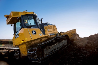
 A Deere 700K equipped with SmartGrade.
In an effort to allow its dealers to offer greater support to customers using 3D digital models and GPS technology for grading, John Deere has announced a partnership with software developer AGTEK.
Deere is integrating AGTEK’s Earthwork 4D site modeling software into its WorkSight telematics dashboard in an effort to “ease the takeoff and modeling process across jobsites of all shapes and sizes.” Deere adds that the partnership will allow contractors to “reduce equipment and labor costs with a streamlined grade-control process…capable of quickly adjust 3D maps to keep construction projects moving forward.”
Deere says Earthwork 4D quantifies and provides field documentation across a wide variety of machinery.
“Collaborating with AGTEK allows our dealers to work closely with their customers to support the whole grade control workflow process. This includes cut and fill maps, demo models and state-of-the-art 3D views of their project,” says BJ Bauman, a WorkSight instructor. “John Deere customers can simply contact their dealer to support the takeoff process, which allows the customer to be more competitive. File conversions are also easily formatted to support SmartGrade demos with existing Trimble or Leica users. The AGTEK solution aligns with our open architecture approach to grade control management as it’s capable of ingesting any 3D environment format.”
The integration is designed to simplify the planning process for contractors, “from moving dirt to estimating how much equipment is needed.”
“Every contractor is looking for a competitive edge, and utilizing AGTEK is an eye-opening experience for our customers. It’s empowering them to use the latest and greatest in technology to attack the job the best way possible and give them a full grasp of the GPS experience,” says Mike Burns, a grade control specialist at JESCO Inc. “We believe in the future of GPS technology as it allows us to put our customers in the best position to succeed; and John Deere working with AGTEK does just that.”
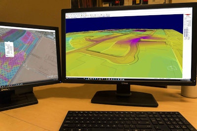 Deere is integrating AGTEK’S Earthwork4D into the WorkSight telematics dashboard.