The GeoSLAM Zeb Revo is a new product that can do for indoor building measurements what GPS did for outside survey work.
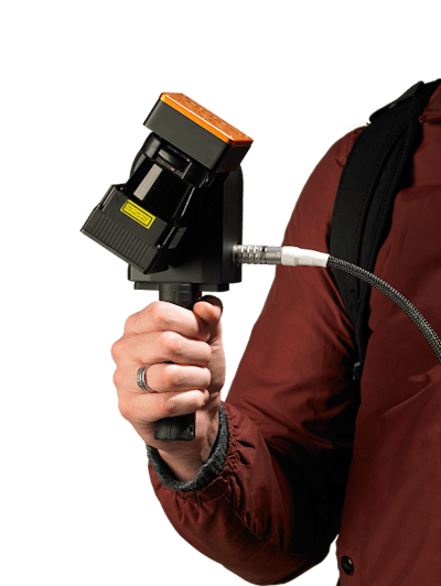
The hardware for GeoSLAM is a handheld, rotating laser device and a backpack battery. The worker simply turns on the device, picks up the laser scanner and walks one loop through a room. The laser scans and records all the three-dimensional properties of any room up to 30 meters in size and the structures in that room. SLAM stands for Simultaneous Localization And Mapping.
The data is assembled into a point cloud rendering and shared through a cloud-based system making it compatible with BIM (building information models) CAD programs, GIS modeling and other collaborative platforms. Once the data is collected in the field, you drag and drop the files to the company’s uploader, or if you want to skip the cloud route, you can pay a one-time fee and process the information locally without having to seek an internet connection.
The company’s software renders the scans into 3D, centimeter-grade maps that can be used with most CAD programs.
The benefit of using GeoSLAM is speed. A person operating the device can create a full-blown, 3D map of any interior space, including many large buildings as fast as he or she can walk the floors. In addition to buildings the technology can be used to map underground mines, caves and forests where the tree cover is too dense for GPS signals.

