 GPS is a remarkable technology with a variety of useful of applications in the construction industry. But in situations where a clear signal cannot be established, such as urban environments and even in large buildings, all of that utility disappears.
That’s exactly where Locata has worked to step in. In October 2011, the company partnered with Leica Geosystems to bring about a GPS alternative technology, called LocataNet. The technology has enjoyed success in large-scale mining deployments and this week the company announced that it will bring LocataNet to the construction industry.
The technology, which powers applications for locating, directing and automating objects and equipment when GPS signals are unavailable, has been so successful that the company has begun supplying the U.S. Air Force with its own LocataNets.
The company explains that while GPS relies on satellites above the Earth, LocataNets are ground-based networks that function as a local replica of GPS. The technology is said to work seamlessly with satellite-based solutions, providing positioning information when GPS signals are unreliable, inconsistent or blocked entirely in environments like open-cut mines, in warehouses, in “urban canyons” or inside buildings.
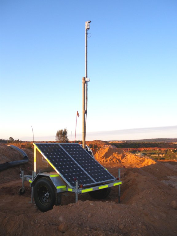
The picture above is a solar-powered signal station that is part of a LocataNet installation.
The company says its technology is meant to fill the gap until the release of a technology it calls GPS 2.0 which will combine the satellite-based positioning of GPS and terrestrial positioning of technologies like LocataNets.
To learn more about how your operation can implement LocataNet, contact [email protected].
Locata’s technology is designed to power new applications for locating, directing and automating objects and equipment when GPS signals are unavailable. LocataNets are terrestrial networks which function as a local ground-based replica of GPS. LocataNets work seamlessly with satellite-based solutions, providing positioning information when GPS signals are unreliable, inconsistent or blocked entirely in environments like open-cut mines, in warehouses, in “urban canyons” or inside buildings.
Locata offers the first and only technology to replicate the GPS system’s precise positioning capability without using satellites. The company today has 92 granted global patents protecting its inventions. This development has enormous implications for organizations that must have impeccable positioning under conditions where GPS is unreliable, or fails completely. One such industry – mining – is leading the world in deploying this new capability because of Leica’s commitment to early adoption, and their rapid integration of Locata positioning into Leica mining systems. Now Locata partners in other markets will be given access to this new enabling technology.