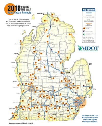
The map, available at www.michigan.gov/mdotmaps, details the general timelines for specific highway and bridge projects segmented by the Upper Peninsula, Lower Peninsula and the metro Detroit and Grand Rapids areas.
Projects are identified on maps of the areas and listed separately on pages within the document. MDOT also will display the map at all of the state’s rest areas and welcome centers.
“Making the yearly construction map available to download leverages technology to help travelers plan ahead,” says State Transportation Director Kirk Steudle. “Remember to slow down in construction zones and avoid all distractions. Road workers are entrusting their lives with you while they focus on the task at hand. Let’s make sure everyone makes it home each and every day during this construction season.”
MDOT also makes construction information available on its Mi Drive traffic website at www.michigan.gov/drive and via its Mi Drive app.


