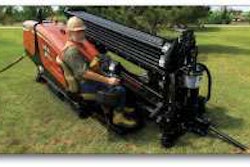
Survey technician using laser scanning equipment
The American Council of Engineering Companies (ACEC) of New York has honored one of Erdman Anthony’s projects as among the best in the northeast region.
The firm’s entry, laser scanning of New York Route 17 Upgrade to I-86, exit 131, earned a Silver Award in the category of surveying and mapping technology.
Considered the Academy Awards of the consulting engineerin
Survey technician using laser scanning equipment
g industry, the annual Engineering Excellence awards “recognize and celebrate engineering achievements that demonstrate the highest degree of skill and ingenuity among member firms.”
This year, the award was presented to Erdman Anthony at a black tie dinner on March 27, 2010 in the Grand Ballroom of The Waldorf-Astoria hotel in New York City.
“We are particularly proud of this award and this project, because it is the largest terrestrial LiDAR (light detection and ranging) survey completed to-date on a New York State Department of Transportation job,” Erdman Anthony CEO Russell Bullock said in a press release. “As a firm that is constantly striving to stay ahead of the curve in its use of technology, we are delighted to be so honored by our peers.”
The award-winning project entailed creating a highly
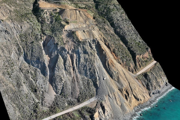
 Point cloud of County Route 105 bridge structure
detailed digital terrain model (DTM) survey of a section of State Route 17, around exit 131. New York State is in the process of converting State Route 17 to Interstate 86 (I-86). Almost half of the 381-mile length of Route 17 has been designated as I-86 and several remaining sections are either under construction or in the design phase.
Erdman Anthony recommended combining terrestrial LiDAR, more commonly known as laser scanning, to survey the road and highway surfaces with conventional topographic surveying to create a highly detailed and accurate digital terrain model (DTM). Terrestrial LiDAR quickly and accurately collects spatial data from a safe location, a feature that made it the perfect field data collection tool for a busy highway like Route 17.
Busy highways such as Route 17 would typically have required costly traffic lane closures while surveyors worked. By eliminating the need for an additional crew of highway workers to man flags or set up traffic control devices, NYSDOT was able to save thousands of dollars while obtaining a highly accurate digital terrain model.